Day 24
1964, the Plan: Regina, SK to Winnipeg, MB.
1964, the Actuality: On Saturday, August 8, the Explorer Scouts were still a long way from home!
Thursday, July 6, 2017
We departed from Seward, AK, heading north on the Seward Highway/AK-9.
 |
| Low clouds |
At Moose Pass, Seward Highway changes designation from AK-9 to AK-1.
 |
| Wispier clouds |
 |
| At the end of Turnagain Arm with its lily pad-filled marsh |
We took the detour East on Whittier/Portage Glacier Access Road, which runs 18 km/11.5 miles to Whittier.
 |
Begich-Boggs Visitor Center at Portage Lake; the center is named for
congressmen Nick Begich of Alaska and Hale Boggs of Louisiana;
both were on a plane that disappeared in 1972 |
 |
Across Portage Lake, we see the "hanging" Burns Glacier,
but the Portage Glacier has retreated around the corner to the right |
 |
| Tamiko with Smokey at the Begich-Boggs Visitor Center (KSS) |
Our timing wasn't right to take the boat, the MV Ptarmigan, to the foot of Portage Glacier.
 |
| The first tunnel, only 137 m/450' long |
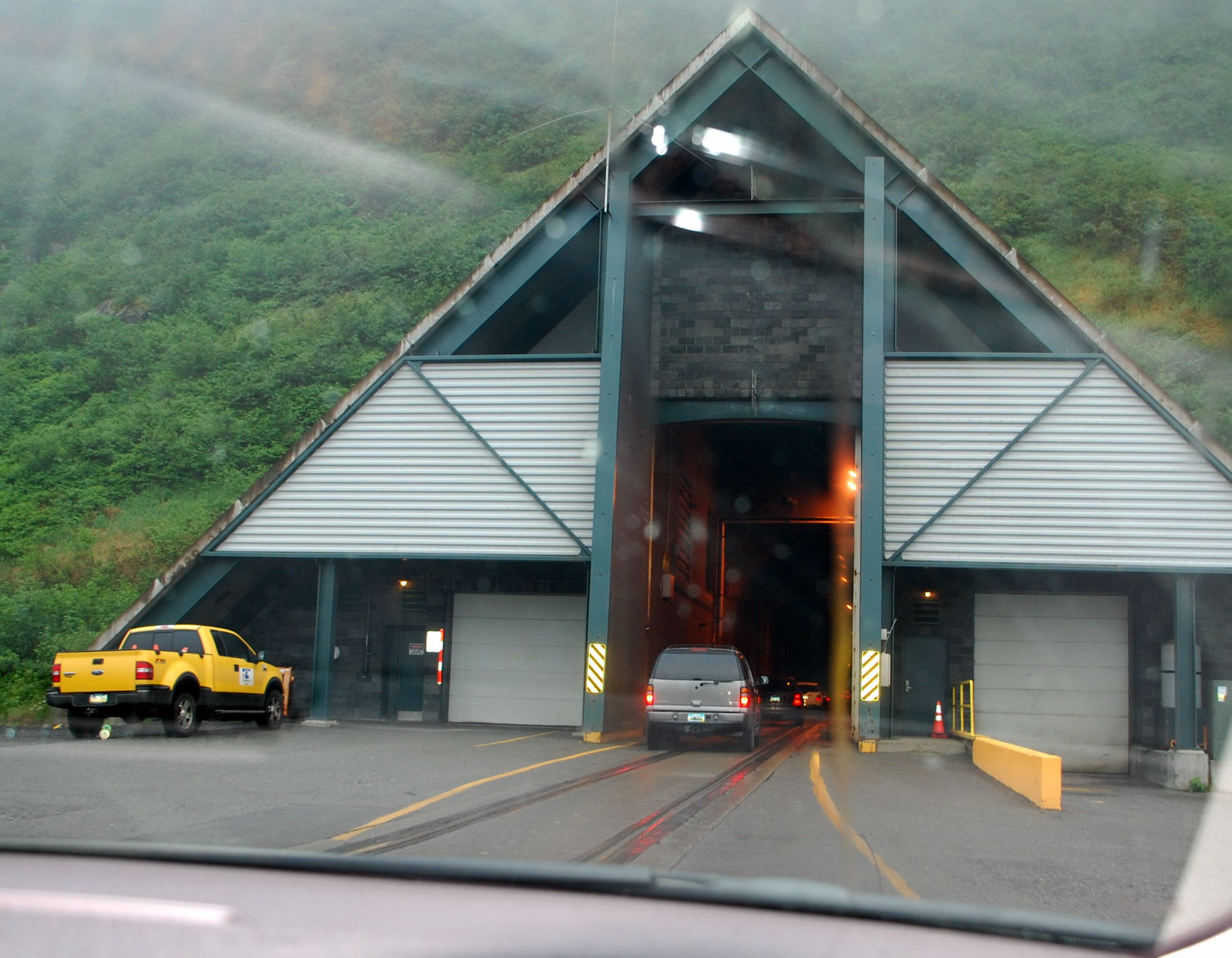
Next we paid the $13.00 toll for the Anton Anderson Memorial Tunnel, and were on time to head right in. Vehicles are stopped by a crossing gate before being given the green light to enter the tunnel at timed intervals. At 4,023 m/13,200', this is the longest highway tunnel and longest combined highway and railroad tunnel in North America. It is only one-lane wide, and generally, westbound traffic goes through in the first quarter hour, and eastbound traffic in the third quarter hour.
 |
| Inside the Anton Anderson Memorial Tunnel |
The tunnel had been a train-only tunnel, built in 1941-1943. In order for cars to reach Whittier, they had to be put on a shuttle train. In 2000, the tunnel opened for vehicle traffic.
 |
| Whittier, AK |
Whittier is the wettest city in Alaska and in the United States, receiving about 502 cm/198" of precipitation each year. The region was the end point of a portage trail used by the Native Chugach people, then Russian and American explorers, and gold prospectors. During World War II, the United States Army chose this site for a military facility, because of the ice-free deep water port surrounded by mountains and apparently because it was almost always under cloud cover. I suppose that initially during the Cold War, it made it easier to hide from the Soviets!
When the military left in 1970, they bulldozed everything except the concrete buildings.
 |
| View of Passage Canal, a finger of Prince William Sound (KSS) |
 |
| Memorial to those lost at sea (1998) (KSS) |
 |
| Carving of Orcas |
 |
| The Triangle section of Whittier with the tourist shops |
 |
| A view of Horsetail Falls just above Begich Towers |
 |
Whittier Small Boat Harbor;
note the blue sky in the next valley! |
 |
| The United States Coast Guard Auxiliary Station is in a caboose |
 |
| Inn at Whittier (2001-2004) |
 |
A pedestrian tunnel under the railroad yards takes you from the
waterfront Triangle to the former military post/town |
 |
Begich Towers (1953-1957, designed by Anton Anderson) was
originally the Hodge Building and provided housing for those
who had been living in a trailer park |
The community purchased the building from the United States Army, and most of the residents of Whittier live here. It also houses many community services, the post office, a grocery, a hospital, a church, and an indoor pool.
 |
| Unique decorations on this log house |
 |
| The former gymnasium (1956) is now a boat shed |
 |
Buckner Building (1949-1953) was built by the United States Army to be
a city under one roof, with administrative offices, housing, cinema,
gymnasium, library, post exchange/PX, bowling alley, rifle range, etc. |
The Buckner Building was abandoned in 1960 when the United States Army left Whittier. It was so well built, it survived the 1964 Good Friday Earthquake with no structural damage. However, being empty all these years, it has succumbed to nature and vandals and is deteriorating quickly. Because of asbestos, it cannot be easily razed.
 |
| Whittier Manor Condos (1954) |
 |
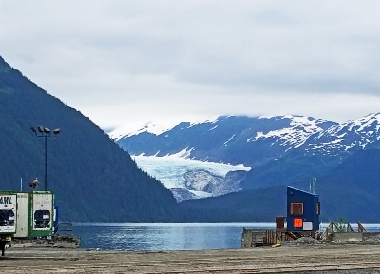
| A retreating glacier across from Whittier |
 |
Anchor Inn (1943, had a 3rd story added by the military and was
used as the Alaskan Army Communications Systems Building) |
 |
Anchor Inn Annex (1954 as the United States Army Headquarters
Building and Post Telephone Exchange) |
 |
Former P-12 Motor Pool Building (1954) that used to be twice as long;
the red-painted area is now the Whittier Fire Department |
 |
| Former Cold Storage Facility (1943) is now a fish processing plant |
 |
| Snow doesn't seem to melt as fast in Whittier |
 |
| Whoa! A train popped out of the tunnel as we waited to go back through |
Back to Seward Highway/AK-1 towards Anchorage.
 |
| We had lunch at the Turnagain Arm Pit for BBQ |
Turnagain Arm Pit is "Home of the Boar Tide," for authentic Southern BBQ, with the "most stellar view of ANY BBQ place in the world."
 |
| View from the Turnagain Arm Pit |
As we approached Anchorage:
 |
One of the snow dumps in Anchorage;
the city has to remove snow to outlying snow dumps,
then hope they melt before the next winter (KSS) |
We arrived at Betsey H's home in Anchorage for another night's stay. We took a walk along Chester Creek Trail in the Greenbelt near Betsey's house. (This trail connects to the Tony Knowles Coastal Trail along the shore of Knik Arm and Cook Inlet. Anchorage has quite an extensive trail system.) The white seeds of the cottonwoods are still blowing around. We returned through the neighborhood streets.
 |
| A most impressive Little Free Library! |
Betsey drove us to the Alaska Heritage Museum located in a Wells Fargo bank building.
 |
| On the way, a bus advertisement... (KSS) |
 |
At the Alaska Heritage Museum, we finally were
able to see some paintings by Fred Machetanz;
The Limitless Arctic (1968) |
The museum had other fine artifacts, and we were able to speak with the curator, a friend of Betsey.
 |
| Dinner was at the Midnight Sun Brewery |
 |
| The smell of the spent grain permeated the air... |
Again, we are indebted to Betsey for so much. Many heart-felt thanks!


No comments:
Post a Comment